
The biggest mistake most people make when planning a trip to Ecuador is assuming that because the country sits directly on the Equator, the weather is a uniform, tropical heatwave year-round. It isn’t. I’ve seen travelers step off a plane in Quito in July wearing nothing but shorts and a tank top, only to find themselves shivering in 50-degree drizzle. The reality is that Ecuador doesn’t have four seasons; it has four distinct geographic regions, each operating on its own internal clock. If you try to apply a single ‘best time’ to the whole country, you’re going to end up disappointed in at least one of those regions. The Andes are dry when the coast is wet, and the Galapagos operates on a marine cycle that has more to do with ocean currents than air temperature. You have to think about this country as a collection of microclimates rather than a single destination.
What is the best month to visit the Ecuadorian Andes?
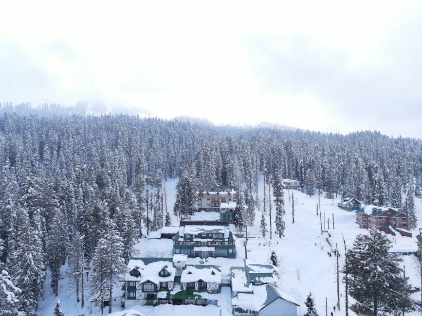
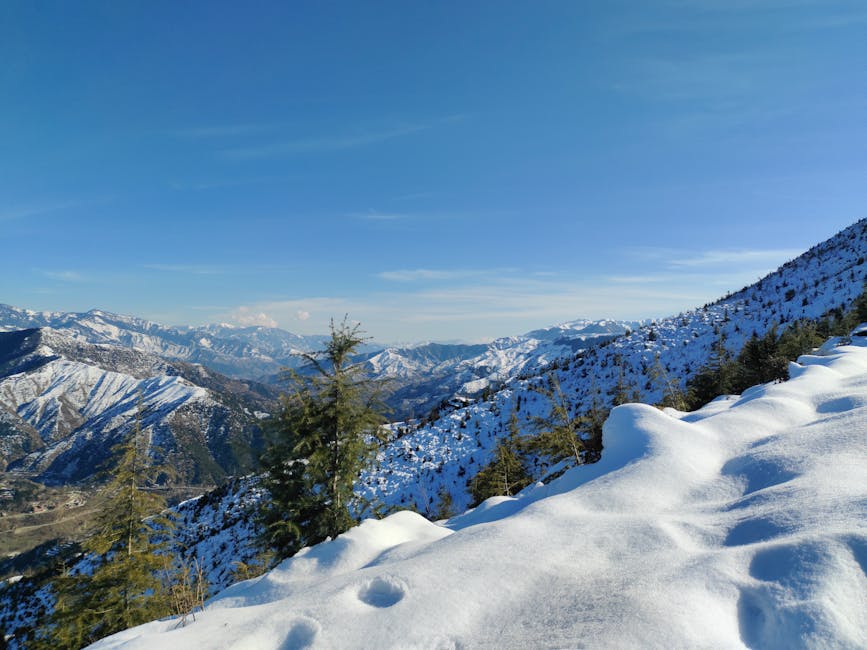
In my experience, if you are heading to the Sierra—the high-altitude spine of the country that includes Quito, Cuenca, and the Avenue of the Volcanoes—the window from June to September is your best bet. This is what locals call the ‘summer,’ though that’s a bit of a misnomer. It’s actually the dry season. During these months, you get the clearest skies, which is essential if you’ve come to see the snow-capped peaks of Cotopaxi or Chimborazo. There is nothing more frustrating than paying for a high-altitude lodge and seeing nothing but gray mist for three days straight. During this dry window, the mornings are usually crisp and sunny, though the wind can be brutal on the paramo (the high-altitude grasslands).
Weather patterns in Quito and Cuenca
Quito sits at roughly 9,350 feet. At that height, the sun is incredibly strong, but as soon as it ducks behind a cloud or the sun sets, the temperature drops fast. During the dry season (June–September), daytime highs hover around 66°F (19°C), while nights can dip to 48°F (9°C). If you visit during the rainy season (October to May), expect ‘four seasons in one day.’ It might be gorgeous at 10:00 AM, but by 2:00 PM, a torrential downpour will turn the cobblestone streets of the Old Town into rivers. Cuenca, further south, follows a similar pattern but tends to be slightly milder and less windy than Quito.
Hiking and climbing conditions
For those aiming to summit peaks like Cayambe or Illiniza North, the dry season offers the most stable snow conditions and the best visibility. However, there is a secondary dry window in December and early January. I’ve found this ‘mini-summer’ to be a hidden gem. The crowds from the northern hemisphere summer have vanished, and while there might be an afternoon shower, the mornings are often spectacular. If you’re booking a trek, like the Quilotoa Loop, aim for these windows to avoid the knee-deep mud that defines the rainy months. A guided 3-day Quilotoa trek usually costs around $250-$350, and you don’t want to spend that money staring at your boots in a rainstorm.
The Andes are unforgiving if you aren’t layered. Even in the dry season, a sudden cloud cover can drop the perceived temperature by ten degrees in minutes. Always carry a high-quality hardshell jacket.
When is the best time for a Galapagos Islands cruise?
The Galapagos is a different beast entirely. You aren’t just dealing with rain; you’re dealing with the Humboldt Current and the Panama Current. I’ve spent a lot of time talking to naturalists in Puerto Ayora, and they all say the same thing: there is no ‘bad’ time, but there are very different experiences depending on when you go. You have to choose between warm water with occasional rain or cool water with dry air.
The Warm and Wet Season (December to May)
This is my personal favorite time to visit. The water temperature is much higher—often reaching 78°F (25°C)—making snorkeling without a thick wetsuit much more comfortable. The sky is usually a brilliant blue, punctuated by short, heavy tropical bursts of rain that clear up quickly. This is also the time when the islands turn lush and green. If you want to see land birds nesting or sea turtles laying eggs on the beaches, this is your window. The ocean is also significantly calmer during these months, which is a major factor if you’re prone to seasickness on a small yacht like the M/Y Grace (approx. $7,500 per person for 8 days).
The Cool and Dry Season (June to November)
During these months, the Humboldt Current brings cold, nutrient-rich water up from the south. This is the ‘Garúa’ season, named after the misty fog that often blankets the islands. While the air is cooler (around 72°F / 22°C), the water temperature can drop to a chilly 65°F (18°C). You will definitely need a 3mm or 5mm wetsuit. However, the trade-off is the wildlife. The cold water brings an explosion of marine life. This is the best time to see whale sharks near Darwin and Wolf islands, and the sea lions are incredibly active. The blue-footed boobies also perform their famous mating dances during this period.
| Month | Water Temp | Wildlife Highlight | Sea Conditions |
|---|---|---|---|
| January | 76°F | Green sea turtles nesting | Calm |
| April | 78°F | Waved albatross arrive on Española | Very Calm |
| August | 66°F | Whale sharks (North), Sea lion pups | Choppy |
| October | 68°F | Blue-footed booby chicks | Moderate |
What are the wet and dry seasons in the Amazon Rainforest?
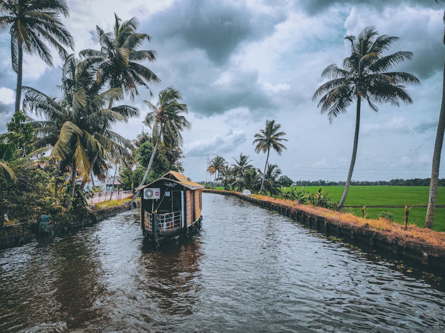
Let’s be real: it’s the rainforest. It’s going to rain. If you go into the ‘Oriente’ (Ecuador’s Amazon basin) expecting a dry week, you’re in the wrong place. However, there is a distinction between the ‘rainy’ season and the ‘slightly less rainy’ season. In the Ecuadorian Amazon, the wettest months are typically April, May, and June. During this time, the rivers rise significantly—sometimes by 20 feet or more. This changes how you experience the jungle. Instead of walking on trails, you’ll spend most of your time in motorized canoes or paddling through flooded forests (igapós).
The benefits of the high-water season
I actually prefer the high-water months for photography. Because the water level is higher, you are physically closer to the canopy when you’re in a boat. This makes spotting monkeys, sloths, and birds much easier. You can navigate deep into small creeks that are inaccessible during the drier months. If you stay at a place like Sacha Lodge (approx. $1,400 for a 4-day program), the high-water season allows you to explore the flooded palm forests which are eerily beautiful. The downside? The mosquitoes are significantly more aggressive, and the humidity is a constant 95%.
The low-water season (December to March)
This is the closest the Amazon gets to a dry season. The water levels drop, exposing sandy riverbanks. This is the best time for spotting caimans and river turtles, as they congregate on the exposed banks to sun themselves. It’s also better for those who want to do more hiking on the forest floor. The trails are still muddy, but they aren’t underwater. The heat can be more intense during these months because there are fewer clouds to block the sun, so you’ll want to pack lightweight, long-sleeved breathable clothing. I recommend the Outdoor Research Echo Hoodie (approx. $70); it’s light enough for the heat but provides UV protection and a barrier against bugs.
When is the best time for whale watching on the Ecuador coast?
Ecuador’s Pacific coast has a very specific rhythm that most international tourists miss. If you want a traditional beach holiday—sun, sand, and warm water—you need to go between December and April. This is the rainy season on the coast, but much like the Galapagos, the rain usually comes in short afternoon bursts. The rest of the day is hot and sunny. During the ‘dry’ season (June to September), the coast is often covered in a thick, gray overcast layer called the ‘camanchaca.’ It’s not great for tanning, but it’s the absolute peak for wildlife.
Humpback whale migration
Every year, thousands of humpback whales migrate from Antarctica to the warm waters of Ecuador to mate and give birth. The best time to see them is from mid-June to late September. Puerto López is the hub for this. You can take a boat out to Isla de la Plata (often called the ‘Poor Man’s Galapagos’) and see whales breaching along the way. I’ve been on boats where a mother and calf spent thirty minutes circling us. It’s a spectacular sight, but keep in mind the ocean is much rougher during these months. If you’re prone to motion sickness, take your Dramamine an hour before you leave the pier.
Surfing and beach culture
For surfers, the best swells hit the coast from January to March. Towns like Montañita and Ayampe come alive during this time. The water is warm enough that you don’t need a wetsuit, and the northern swells provide consistent breaks. If you go in July or August, the water is colder, the sky is gray, and the vibe is much more subdued. However, the prices for beachfront hostels also drop by about 30% during the gray months, so if you’re on a budget and don’t mind the overcast skies, it’s a viable option.
How do Ecuadorian holidays and festivals affect travel timing?
Timing your visit isn’t just about the weather; it’s about the cultural calendar. Ecuadorians love a festival, and if you happen to be in a city during a major celebration, your experience will be completely different. However, this also means prices for hotels spike, and transportation (like the bus system) becomes a chaotic nightmare. You need to decide if the cultural immersion is worth the logistical headache.
Inti Raymi and the Summer Solstice
In late June, particularly around the 24th, the indigenous communities in the northern Andes (especially around Otavalo and Cotacachi) celebrate Inti Raymi (the Festival of the Sun). This is one of the most authentic and powerful cultural experiences you can have in South America. There is music, dancing, and ritual bathing in local springs. If you plan to be in Otavalo during this week, you need to book your accommodation at least three months in advance. Prices at popular spots like Hacienda Zuleta (approx. $400/night) will be at their peak, and they will be full.
Semana Santa and Carnival
Holy Week (Semana Santa) in Quito is famous for the ‘Jesús del Gran Poder’ procession. It’s a somber, intense event with thousands of ‘cucuruchos’ (penitents in purple robes) walking through the streets. It’s fascinating, but the city effectively shuts down. Carnival (usually in February) is the opposite—it’s a country-wide party. In cities like Ambato and Guaranda, they have massive parades. In other places, it’s a tradition to throw water and flour at strangers. If you don’t want to get soaked while walking to dinner, you might want to avoid being in town during Carnival.
The Shoulder Season Advantage
If you want the best balance of decent weather, lower prices, and fewer crowds, I always recommend the shoulder months: May and November. In May, the rains in the Andes are beginning to taper off, and the Galapagos is still warm. In November, you have the ‘Mama Negra’ festival in Latacunga (early November), which is an incredible spectacle, but you’re still ahead of the massive Christmas and New Year’s rush. I’ve found that I can often negotiate better rates for private tours or last-minute Galapagos cruises during these months, sometimes saving up to 40% off the list price.
- Peak Season: June to August, December to January. Expect high prices and crowded trails.
- Low Season: February to April (except Carnival/Easter). Great for deals, but be prepared for rain in the Andes.
- Wildlife Peak: June to September for whales and Galapagos marine activity.
Ultimately, your ‘best time’ depends on your priority. If it’s photography and clear mountain views, stick to the northern summer. If it’s snorkeling and swimming with sea lions in comfort, aim for the first half of the year. Just don’t expect the Equator to do all the work for you—Ecuador’s geography is much more complex than a line on a map.


")